Burn-Pile Volume & Emissions from Mobile LiDAR
UC Berkeley · Battles Lab, Environmental Science, Policy & Management
A field-validated method for estimating slash-pile volume and emissions by reconstructing mobile laser scans in 3D, cutting error roughly eightfold against the standard field method.
- Role
- Co-equal second author; method development, 3D reconstruction pipeline, and field data collection
- Dates
- Jun 2025 – Present
- Advisor
- Dr. John Battles
- Status
- Manuscript in preparation
The problem
Pile burning is one of the main tools for disposing of forest residue, and estimating its emissions requires knowing how much biomass each pile contains. In practice that number comes from measuring a pile by hand and fitting it to a geometric solid. That is fast and standard, but imprecise: slash piles are not cones or half-ellipsoids, and their packing ratios vary.
Approach
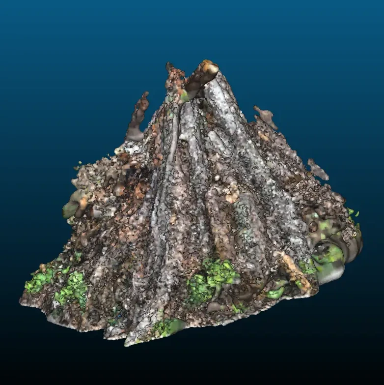
We scan piles with a mobile laser scanner, reconstruct each one in 3D, and calibrate the reconstructed geometry statistically to physical mass rather than assuming a shape. The uncertainty can then be quantified instead of assumed.
Validating it required piles whose true mass was known, so we built them. Data collection ran across three field campaigns: Blodgett Forest Research Station, Tilden Regional Park, and Russell Research Station.
Result
Against 15 hand-built piles of known mass, the method substantially outperformed Wright's method, the standard field approach:
| Wright's method | This method | |
|---|---|---|
| RMSE | 58.0 kg | 8.6 kg |
| Bias | −23.1% | 0.1% |
The bias figure matters as much as the error. Wright's method systematically underestimates, whereas the new estimate is close to unbiased.
My contribution
I developed the reconstruction and calibration method and ran the field data collection across the three campaigns. I am a co-equal second author on the resulting manuscript, with A. Olah as first author and Dr. John Battles as senior author, and I presented the work as a poster at CASIS 2026.
Output
- Olah A, Pearce A*, Saah A*, Battles J. Mobile LiDAR-based estimation of slash pile volume and emissions (B-PEAs). In preparation.
- Olah A, Pearce A* (presenting author), Saah A*, Battles J. “From Point Clouds to Physical Quantities: 3D Reconstruction for Burn-Pile Volume Estimation.” Poster, CASIS 2026, Lawrence Livermore National Laboratory.
- B-PEAs, software automating volume and emissions estimation from segmented MLS scans. Public release pending manuscript submission.
* denotes co-equal contribution as second authors.